
Bel-Air Real Estate Agent
Bel-Air sits between the 405 and Beverly Hills, with winding hillside roads, private estates and pockets near Sunset Boulevard. Our 11630 Bellagio Road transaction gives us a direct local reference point.
Where people buy in Bel-Air
East Gate and Stone Canyon
Estate streets climbing from Sunset Boulevard, with steep grades and varied lot shapes.
Lower Bel-Air
Homes closer to Sunset Boulevard and the UCLA side of the neighborhood.
Bel-Air Crest and upper hills
Gated and hillside pockets with longer drives; check a specific address for access and any association rules.
Life around Bel-Air
Schools and landmarks
Marymount High School is a private school in the wider Westside area. Public school assignments vary by address. The Getty Center is a landmark just west of Bel-Air.
Work connections
UCLA, Westwood medical and professional offices, and the 405 are relevant to many Bel-Air commutes. A hillside address can add meaningful time to a trip, so test the actual route.
Selected area transactions
These are historical transactions, not a live listing feed. Confirm any current listing directly.
Further reading: local history, dining and projects
Getting to know Bel-Air
Bel-Air is a hillside neighborhood rather than one uniform market. Lower Bel-Air sits closer to Sunset Boulevard, while Stone Canyon and upper streets involve steeper roads, larger parcels and more privacy. The Getty Center is just to the west; UCLA, Westwood’s medical and professional offices, and the 405 shape many commute decisions.
Dining is usually a short drive rather than a walk from an estate street. The Restaurant at Hotel Bel-Air is a neighborhood landmark; Westwood and Beverly Hills bring further choices. Marymount High School is a private option in the wider Westside. Bel-Air mailing labels are not a school-boundary guarantee, so check the property’s jurisdiction.
Bel-Air beyond the gate
Bel-Air grew from Alphonzo Bell’s 1922 land purchase; the first residential tract followed in 1923, according to the Bel-Air Association. Bellagio, Nimes and other street names still carry the early planning identity. The hotel began as Bell’s estate-planning office and opened as Hotel Bel-Air in 1946. The modern neighborhood includes very different drives and parcels from lower Bel-Air near Sunset to Stone Canyon and upper hills. Gates at individual homes or enclaves should not be conflated with a single gate around all of Bel-Air.
Golf, gardens and a real trail
Bel-Air Country Club on Bellagio Road is a private golf club; a nearby address does not include membership. The Getty Center lies just west of the 405, and Franklin Canyon Park to the east has a lake, oak woodland and hiking trails. These are outings, not walkable promises from an estate driveway. For one home, the exact road grade, fire-zone rules, insurance and travel time can carry more weight than distance on a map.
Schools and dining, by address
Roscomare Road Elementary is a public campus in the hills; its enrollment boundary must be checked for the property. Marymount High School is private, and admissions are separate. Within Bel-Air, The Restaurant at Hotel Bel-Air is a longstanding dining destination, while most everyday coffee and restaurant choices involve a drive to Westwood, Brentwood or Beverly Hills. We do not sell a canyon address as a walk-to-cafe location without testing the route.
Watch the neighboring districts, not imaginary construction here
Nearby One Beverly Hills is a major mixed-use project under construction at Beverly Hills’ western gateway. It is outside Bel-Air and does not imply new construction on a given Bel-Air street. For a purchase, we focus on property-specific permits, setbacks, hillside and access requirements, then distinguish those from a project across a city line.
Check the specific address: school eligibility, access, insurance, permits and commute depend on the property.
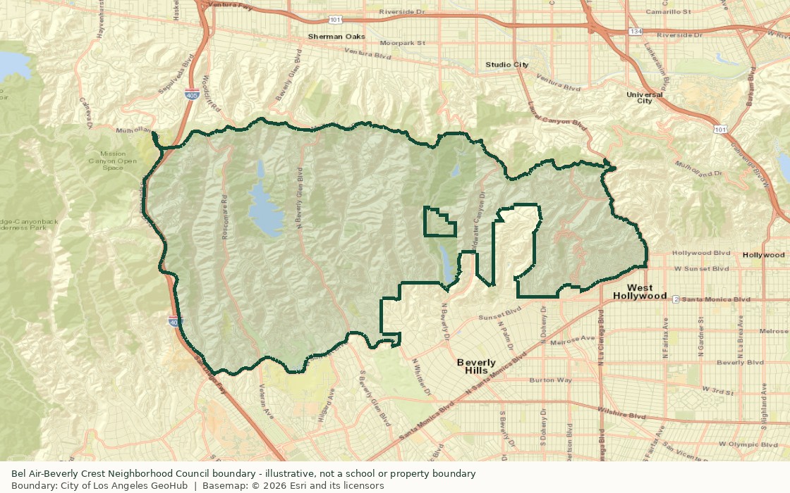
Bel-Air area map
Buying or selling in Bel-Air?
Call us at 310-861-7377 or stop by 12080 Ventura Place in Studio City.